

Apart from Coopers Knob (ZL3/CB-806), the only other approved summit in Christchurch’s Port Hills is Mt Pleasant, at the other (eastern) end of the hills and directly above the port of Lyttelton to the south.
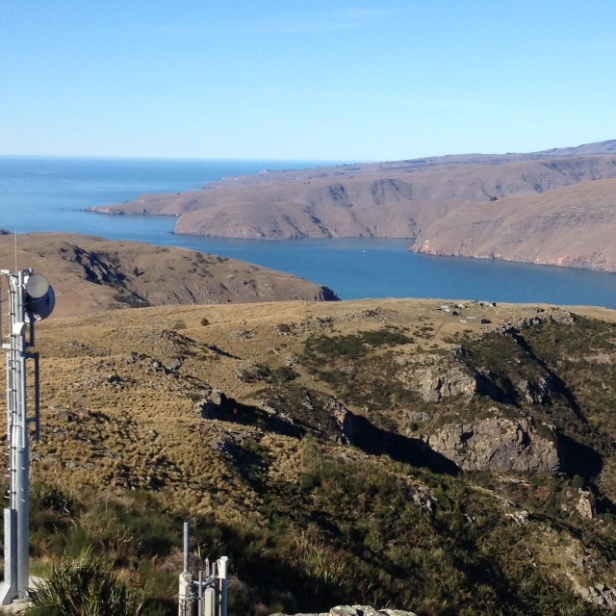
There is a comms site on the summit, so there is easy access but on the other hand a large amount of RF interference to contend with.

After a bumpy drive up the start of the access road I decided to walk the last 100 metres or so, and set up the dipole on the summit ridge about midway between the two large commercial antenna poles. The RF soup surrounding me made frequency selection a bit difficult but having settled on 7.080 I was able to make several contacts with both locals and ZLs further afield. A summit-to-summit Andrew-to-Andrew contact was had with VK1AD on 20m, and just before packing up Warren ZL2AJ made it to the top of Maungakawa and I had my first ZL-ZL S2S. A successful activation with 10 QSOs in all.
Unfortunately I ran out of time to look for more VKs on 20m, but this is such an easy summit to get to, I’m sure there will be many other opportunities. Thanks to the chasers.


ZL3/CB-822 Tauhinukorokio/Mount Pleasant
Height: 499m ASL
Access: Drive to the top of Mt Pleasant Road, to meet the Summit Road. Turn right, then very soon turn left into Broadleaf Lane. At an unlocked gate, this lane becomes a deeply-metalled road to the comms site at the summit. Park at the gate and walk, or drive up the track (through another unlocked gate) to within about 10 metres of the summit if you wish.
Time to summit: 30 mins from Christchurch
Summit marker: Trig beacon
Land access permission: Not required, public reserve land
Map: NZ Topo Map
More information: sota.org.uk

ciao Andrew,thanks for activating this site and certainly a pleasure to work you while you were there. 73 de ZL1PO John Lisignoli
LikeLike
Thanks John, good to work you.
LikeLike
Hi Andrew, thanks for changing bands to 14.315 MHz. Great to complete a S2S with ZL3 and of course an Andrew to Andrew S2S too.
Cheers,
Andrew (VK1AD)
LikeLike
Thanks Andrew, we’ll do it again
LikeLike
Great to see another ZL member out and about activating and getting involved with SOTA (Emma)
LikeLiked by 1 person