

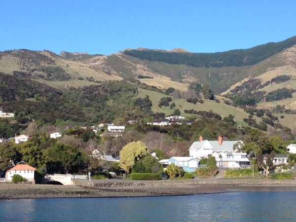
Mist was still hanging around the hills as we set off for Akaroa, in search of some easy summits around the crater rim. Akaroa is a tourist destination trading heavily on its history of French settlement – this was to prove most apt.
After a warming coffee in Little River we continued the drive up to Hilltop, from where we could see our first objective, Lavericks, still shrouded in cloud. Perhaps it would clear before we got there.
Lavericks ZL3/CB-757
It didn’t. By the time we parked at the Otepatotu Scenic Reserve the north-easterly wind had built more cloud up against the tops, so we were in for a chilly activation. The loop track climbs up through a nice reserve of remnant podocarp forest before opening up at the summit, where the repeater wind turbine was spinning well, but views of the harbour below were brief.

We set up amongst the bush just below the top, and started on 40m. Conditions were poor and most locals difficult to contact. A change to 20m was successful in bringing the required 4 QSOs, and then suddenly one of the strongest signals of the day. I had to ask him to repeat the call, as I couldn’t quite believe it: F5RAG. Bill ZL3NB had put a spot for me on the DX cluster, thus creating the French Connection – thanks Bill! Iñaki gave me a 58/59 report into south-west France via the long path – not bad for 20 watts into a low dipole. Of course, his antenna was doing most of the work.
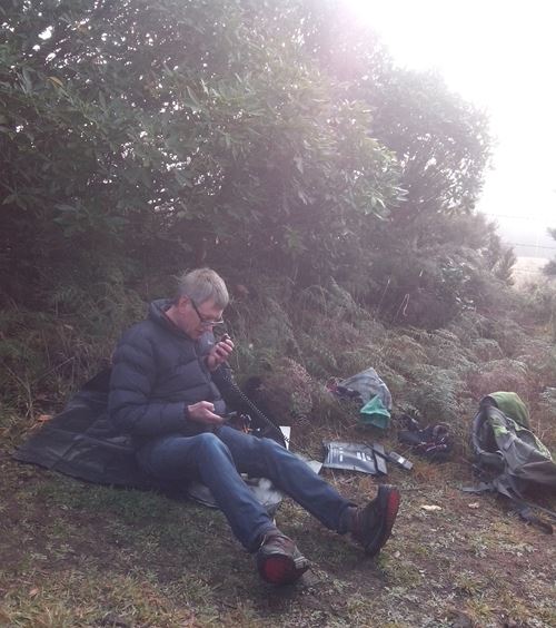
There was time for one more contact before the cold got to us. A short but sweet activation.

ZL3/CB-757 Lavericks
Height: 755m ASL
Directions: Drive to Little River, about 45 minutes from Christchurch. Continue on the Akaroa highway to Hilltop, then follow the Summit Road around to the Otepatotu Scenic Reserve carpark. Walk up to the summit via the loop track, time is much the same via either side of the loop.
Time to summit: 80 mins from Christchurch via Little River and Summit Road – 65 mins drive, 15 mins walk. 30 mins from Akaroa via Long Bay Road and Summit Road – 15 mins drive, 15 mins walk.
Summit marker: Repeater station with wind generator
Land access permission: Not required, Otepatotu Scenic Reserve
Repeater access: Good into 146.75 Mt Grey.
Cellphone access: 3G from the very summit. None from our operating position.
Map: NZ Topo Map
More information: sota.org.uk
Flag Peak ZL3/CB-737
After lunch in Akaroa and a look around, we had warmed up enough to tackle another summit. We were in sunshine and so was Flag Peak.
Once parked at the top of Stony Bay Road, this one was an easy walk along the Misty Peaks Track (an old farm road) below the summit until we could easily get onto the ridge up from the southwest. A bit of scrambling through tussock and speargrass brought us to a fence. I figured I would need to get a bit higher to get into the activation zone, so squeezed through. I assumed this was OK as this was a scenic reserve according to DOC maps. The wind made setting up the antenna a bit difficult but at least I was in sun. 40m conditions were still poor, but 20m brought some good VK contacts. I decided to give my new CW paddle a try and managed two QSOs before struggling with a third – my decoding skills are still not good enough. It was fun to try though and I’m keen to do more.

A good day out was completed with a meal back down in Akaroa, before driving home.
ZL3/CB-737 Flag Peak
Height: 809m ASL
Directions: Drive up Rue Balguerie and continue when it becomes Stony Bay Road. This becomes unsealed and narrows considerably as it ascends to the ridge. Park at the top. Walk back down the road a short distance to the Misty Peaks track, and follow this along, under Flag Peak, until you can easily leave the track to ascend the summit on its southern side. A fence must be crossed to reach the activation zone.
Time to summit: 40 mins from Akaroa – 15 mins drive, 25 mins walk
Summit marker: Repeater station
Land access permission: Not required, Misty Peaks Reserve / Armstrong Scenic Reserve
Repeater access: Good into 146.75 Mt Grey.
Map: NZ Topo Map
More information: sota.org.uk

Excellent stuff well done Andrew. Unfortunately I wasn’t around to work you.
73 Mark ZL3AB
LikeLike
Really do appreciate your efforts (and Julia) for putting on these hill tops (SOTA style that is). What a difference between the weather conditions of Lavericks and Flag Peaks. Your a Gun-Ho Ham Andrew and yes it was really a pleasure to work you on 20 CW. Keep at it and in no time you will be up with the rest of us with using a paddle.
I look forward to your next adventure!
73 Bill ZL3NB
LikeLike