
A short holiday at Moeraki, with a day trip to Dunedin, allowed us to activate a couple of summits in the Otago Region.
Puketapu ZL3/OT-514
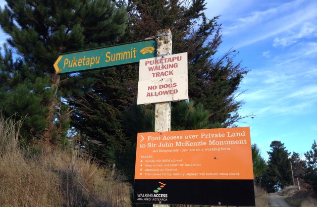
Right next to the small town of Palmerston, and overlooking State Highway 1, sits Puketapu, a cone-shaped hill topped by a large monument to local farmer and politician Sir John McKenzie.
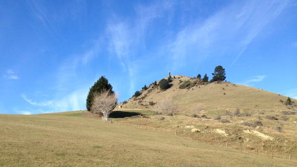
The track to the summit was well-signposted and initially easy to follow across farmland, via several large stiles over the fences. After the last stile the most obvious track heads straight up to the summit. This didn’t appeal to us so we headed slightly right and took our own less slippery but still steep route to the ridge, and from there to the top. As we later discovered, we should have continued around the north side and up from the east.
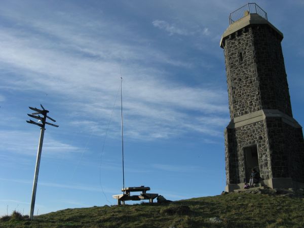
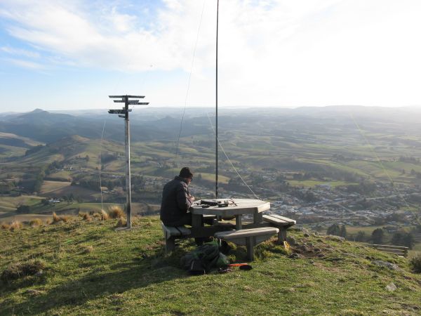
There was a handy picnic table at the top to set up my station on, but a cold wind – Julia sheltered on the steps of the monument.
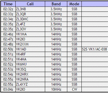
Due to recent poor conditions on 40m, I had added the 80m extensions to the linked dipole, and started there. This brought the required contacts from friends in Christchurch, and a change to 20m gave me some good VK QSOs including John VK6NU and a S-to-S / A-to-A with Andrew VK1AD.
We headed down via the correct route on the ridge to the east, and then around the north side of the hill.
ZL3/OT-514 Puketapu
Height: 343m ASL
Directions: Track begins near the south end of Stour Street, Palmerston. Cross several stiles, then circle around the north side of the hill and ascend the east ridge to the top. Fence posts topped with yellow plastic bags occasionally mark the way.
Time to summit: Approximately 45 mins walk
Summit marker: Monument
Land access permission: Foot access permitted over private land, closed during lambing, obey signs
Repeater access: Good into Mt Cargill (Dunedin) repeaters
Map: NZ Topo Map
More information: sota.org.uk
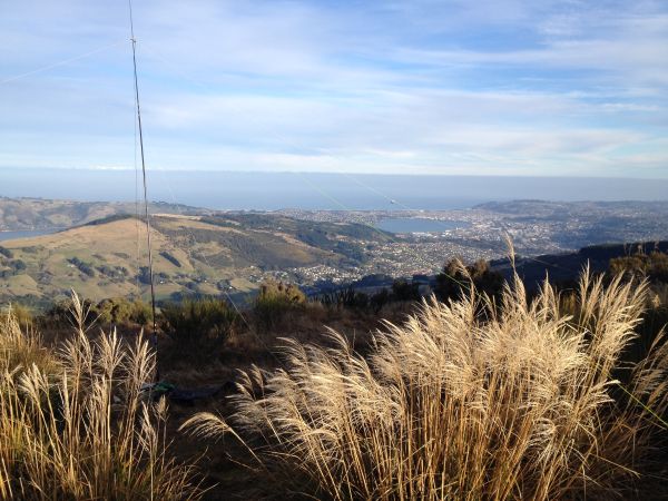
Mount Cargill ZL3/OT-454
The main broadcast transmitter site for Dunedin, with road access and great views.
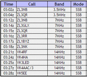
This time propagation to Christchurch was better on 40m than 80m. Contacts with VK on 20m were mostly difficult. There was no noise showing on the S-meter, but perhaps the receiver was being desensitized by all the RF from nearby transmitters.
ZL3/OT-454 Mount Cargill
Height: 676m ASL
Directions: Travel via Pine Hill Road and Cowan Road up to the summit lookout carpark
Time to summit: Approximately 20 mins drive from central Dunedin
Summit marker: Trig beacon, broadcast tower, satellite dish, you name it, it’s here
Land access permission: Not required, public reserve land
Map: NZ Topo Map
More information: sota.org.uk

Thanks for the contacts, and looking forward to your next adventure.
Geoff ZL3QR.
LikeLike
Good read Andrew, picnic tables are few and far between in VK1. I can’t think of a VK1 summit with a table, zip, zilch, none. Thanks for the S2S and A2A contacts 🙂
Andrew VK1AD
LikeLike
Thanks Andrew. I can’t think of another one here either.
LikeLike
Sotago… love it!
LikeLike